LOCAL PREFERENCES FOR RESILIENCE
A COMPARATIVE STUDY OF TWO WATER-LOGGED SOUTH-WESTERN VILLAGES IN BHOBODOHO, BANGLADESH
M. Arch Thesis (Independent Research), 2021
Research Duration: 24 Months
Bangladesh's dynamic and diverse coastal region is currently threatened by irrefutable climate change, which causes constant flooding, rising sea level, coastal erosion, subsidence, and salinity. The Bengal basin, formed by the deposition of alluvial sediments from the Ganges, Brahmaputra, and Meghna river systems, is the youngest and most tectonically active drainage basin in the world. The rivers of southwestern Bangladesh's Khulna region are characterized by active sediment deposition, significantly reducing drainage capacity.
A coastal polder was constructed in southwestern Bangladesh to protect urban and agricultural land from tidal and monsoon flooding. The river's natural flow has ceased because the tides have deposited sediment in the riverbeds instead of the floodplains due to polders and chronic waterlogging. In the context of worsening climate change, flooding is a critical issue for the people of Bangladesh's southwestern region. Long-term flooding has resulted in a significant settlement and livelihood displacement, posing humanitarian challenges in safe water supply, sanitation, housing, food security, and employment. In Bangladesh, temporary flooding may be common. However, over the past 35 years, approximately one million people in Khulna, Jessore, and Satkhira's eight upazillas, Abhoynagar, Monirampur, Keshabpur, Dumuria, Tala, and Phultala, have been affected by waterlogging.
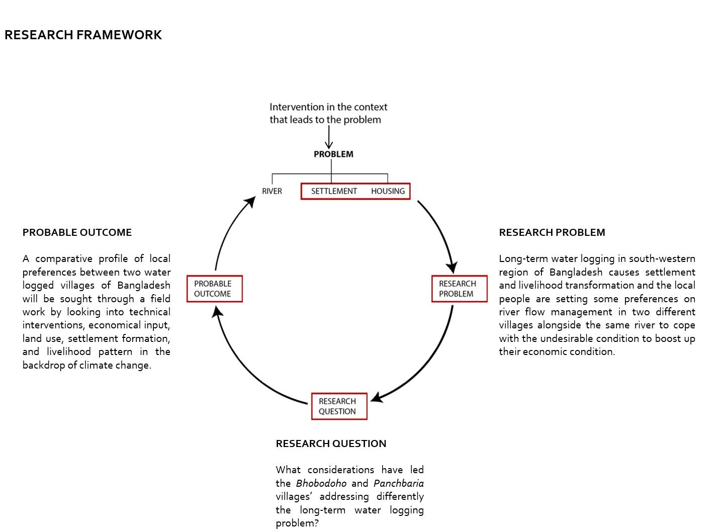
This study will focus on the problem of waterlogging in two villages in the south-west: Bhobodoho, an upstream village, and Panchbaria, a downstream village, both of which are located along the same river, the Mukteswari River (a distributary of Bhairab River). In an effort to contribute to a sustainable relationship between rural settlements and rivers, this study investigates the role and involvement of local preference on river hydrology in transforming a settlement's resilient system in the context of climate change, taking into account technical interventions, economic input, land use, livelihood pattern, and geographic hydrological location of two water-logged villages in the southwestern region of Bangladesh.
The research continues with three specific objectives to investigate the external influences on conflict entanglement in two studied settlements along the Mukteswari River under normal and abnormal conditions. To achieve the research objectives, a comparative case study methodology involving questionnaire, interview, and observation for qualitative data collection and analysis was employed. By examining technical interventions, economy, land use, settlement formation, and livelihood pattern against the backdrop of climate change, a comparative profile of local considerations and preferences in two waterlogged villages of Bangladesh will be determined through fieldwork.